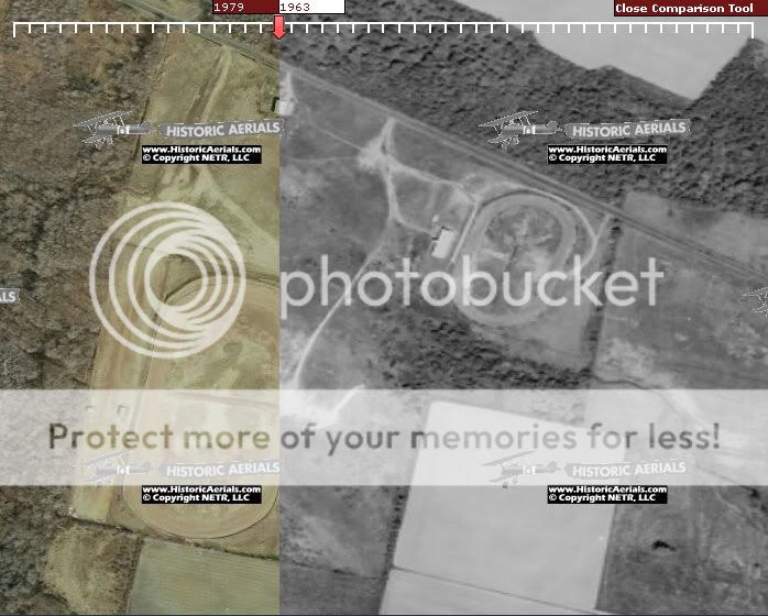
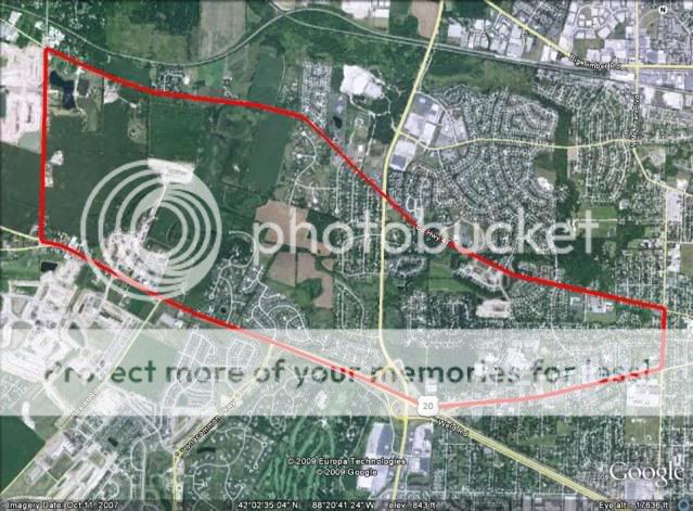
Also on this property was 1/5 mile dirt oval Airport Junction Speedway ran 50-51 paved and renamed Hightstown Speedway aka Central Jersey Speedway ran 52-60. the Ghost can be seen in the 2 front parking lots near Airport Road, the main entrance cuts across the ghost. If you view it on GE and zoom out to 8600 ALT you can see it pretty well
This is in response to the post # 925 in this same thread.
I found this website doing a search for a specific track and came across this particular post. When it comes to Dirt tracks East Windsor Speedway was one of my regular visited tracks, and looking over this post, I saw a glaring problem. Now, while there was a 1/5 mile track on the property before the 1/2 mile dirt track was built, it did NOT stretch across the two parking lots in the front across the entrance road. Now while it APPEARS that there may be remnants of the old speedway, or as you call it a ghost, there are no visible clues as to where the track was other than a concrete slab in the right hand parking lot where the grandstands used to be. If where you say the track was stretching across both lots, it would have been much larger than 1/5 mile, but rather 3/8 or 4/10.
After many hours of research I was able to come up with the exact location of the original racetrack. I made this composite from historicaerials.com showing the track property in 1979 compared to 1963. Hope this helps!
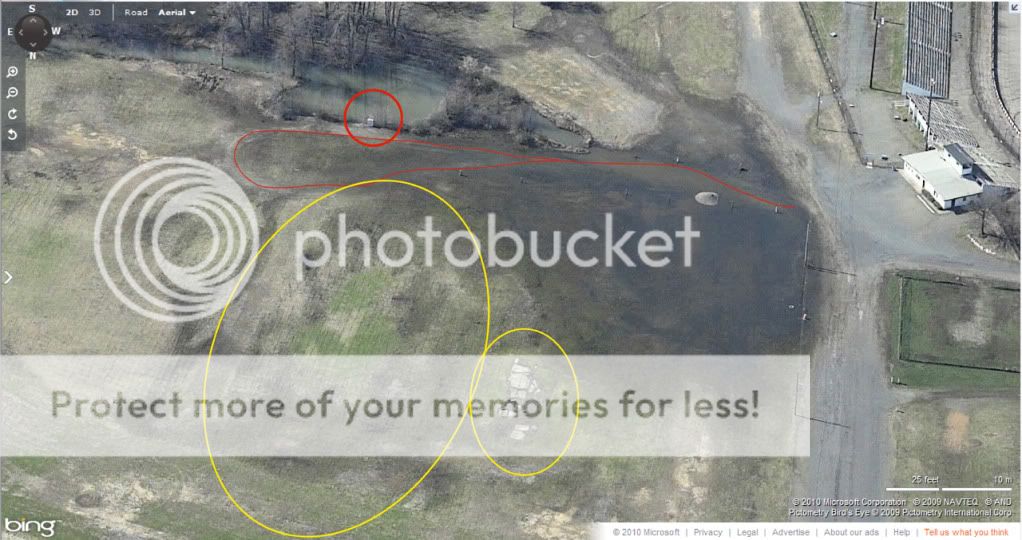
Also here is a more recent pic (mid 2000's) showing the parking lot and all that remains of the slab where the original stands were...
Follow this link to see a few more composites I created showing different eras of the property, as well as photos from Bing maps in 2009 of what the property became.
ews picsAnd even more viewing pleasure, this link is to an album I took of East Windsor Speedway on New Years Eve 2007. It is just before dismantling took place and really shows how the property looked after sitting 5 years and an optimist could look and see just how easy it would have been to start it back up...
EWS 12/31/07And lastly, a gallery of my visit to the property about 6 months later on July 4th weekend and the ghost town it became...
what's left...I know this is my first post on this forum, and I don't want to appear to be coming across as a know it all, but when it comes to East Windsor Speedway, I love sharing the information that I know.... RIP old friend!
Edited by broncopimp94, 29 May 2010 - 15:34.


