
Some have been shown me by nice people, others I've found through my own searching, still others are simply there!
Yesterday I looked for Bern. Starting with a circuit map (not a good one) from the internet and a partial map of the city, I was immediately struck by the total absence of anything that looked like it!
I went to the Bern tourist information office, the girl there ("You mean the bicycle grand prix?") did her best, but she came up with nothing and her superior told her that there were other people to help. She did give me a phone number, however, of the city council.
On phoning them and getting through the language barrier I found a very helpful chap in the archive department, his name is Roth. He quickly googled up the map I have and saw on it 'Wohler' and 'Eymatt', so he put two and two together and gave me the location of the intersection of Eymattstrasse and Wohlerstrasse. And told me that most of the roads included in the circuit could not be driven on now.
It seems that the 20th century did a lot to the area, two freeways cut across the circuit and the city expanded the Bremgarten Forest and so altered the landscape very much in the area.
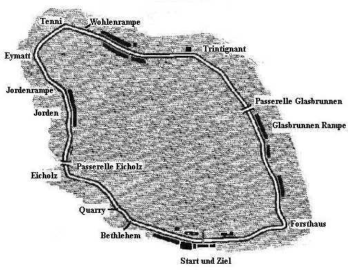
Here's the circuit map from which I was working (apologies to whoever had it on the net, I've forgotten so I can't credit you):
And here's the Google Earth image of the area today:
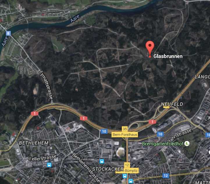
While the name 'Eymattstrasse' is shown on the main link road (effectively a freeway section), it's not right. Eymattstrasse is the road which is immediately to the left of that, curving around from it at its top end and heading down through the small residential section before going into the bush. At that point the name changes to Eicholzstrasse and it is still in keeping with the broader interpretation of the map as it reaches down the the freeway.
At that point there is a narrow bridge across the freeway and in the residential area there you see the name 'Bethlehem', again a connection that fits in with the map.
The general shape of the roads where Eymattstrasse crosses that main link road is as per the map, but the Eicholzstrasse section is so narrow that it's hard to believe this is actually an old piece of racing circuit.
We need someone on the ground in the area with some time to spend more effectively pursuing this issue. There must be old maps of the city (I'm sure Roth would help get them out of archives) and we must be able to create a more accurate map of the circuit and find more links with the present.
If anyone wants to help, please post here or e.mail me. I don't like to give up on these pursuits...


