
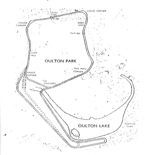
I have always felt the same way about the published maps of Oulton Park, especially the one that appeared in the programmes prior to the 'Fosters' emasculation of the circuit.This always puzzled me as a nipper Barry. I recall in early books that I picked up from my library, and perhaps in my "Letts" motor racing diaries that it indicated a round sweep into Hill Top instead of a most definite 180 degree turn. Also it was dubbed "Covert Bend", pre Esso. I think it has the "sweep" in some of my 60s programmes too.
I mentioned it to Phil last Thursday as he brought along a selection of old programmes with the "sweep" depicted, and I recall he said he had no idea of why it was misrepresented, Sorry Phil if my memory has failed (again).
Rob

I believe that the inaccuracies are due to the fact that the map was produced from an old aerial photo of the circuit - a very large copy of which used to reside in the back of a garage next to the old scrutineering bays in the paddock. This photo appeared to have been taken from a fairly oblique angle with the camera position some way away from the circuit behind Old Hall - hence the curves at Island round to Hill Top appear much more accute that they are in practice.
I have also been looking at some copies of Cliff Hammond's old Oulton Park photos that I have and these show that the run from Shell to Hill Top appears to be a very long sweeping curve - just as I recall it from the early 70's.


 Nice one Tim!

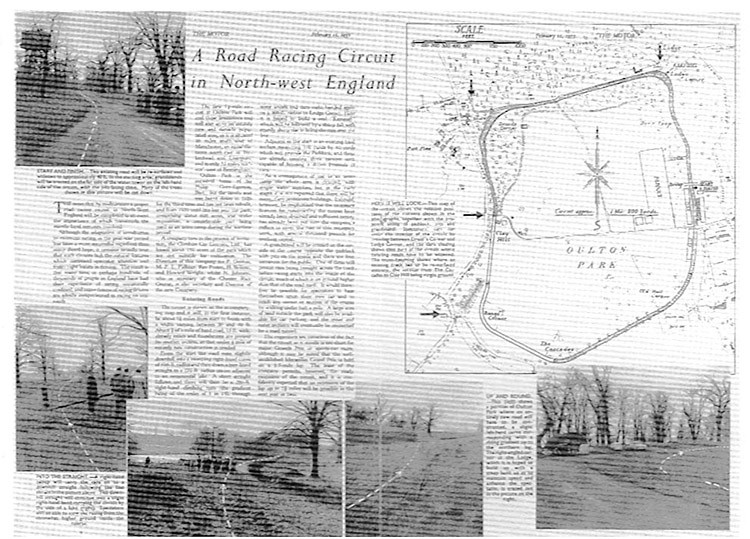
 from 1953. Copied from the 25th anniversary booklet.