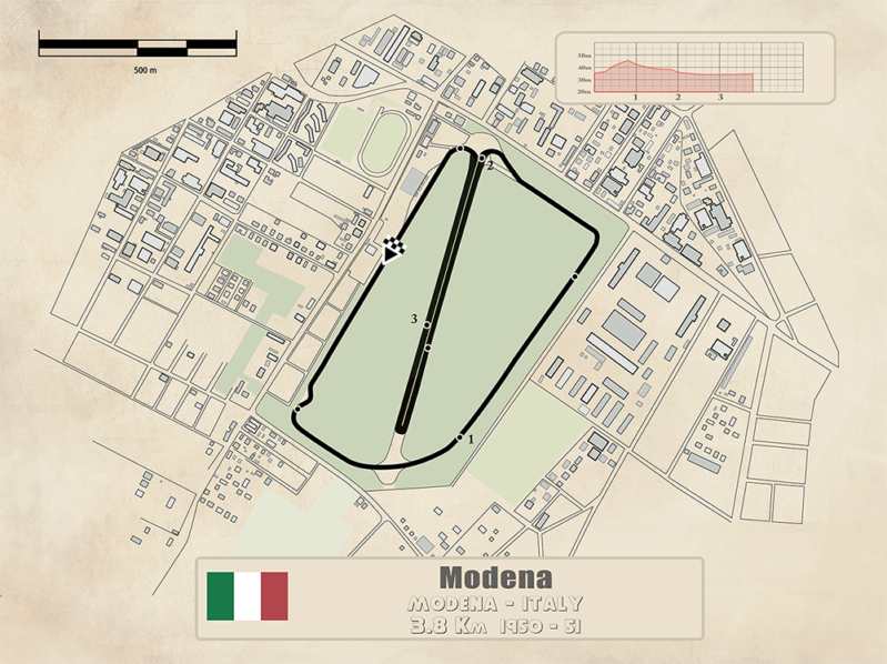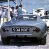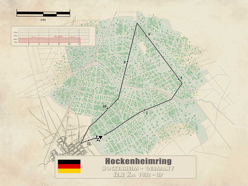
Sorry - but I don't think this Modena circuit plan is right for 1934-37. See this photo, below, of Nuvolari at the 1936 race in his Scuderia Ferrari-entered Alfa Romeo 12C-36.
Photo: Zagari/Spitzley Collection
He is rounding the Monumento ai Caduti delle Prima Guerra ('Memorial to the Fallen of the First War') roundabout, before presumably heading back westward on the Viale delle Rimembranze ('Avenue of Remembrance') towards the start/finish area. A sister Alfa is just visible heading right before locking left to follow in Nuvolari's wheel tracks. This isn't compatible with the track plan above (sorry Oscar).
There is a park road leading into the Monument site today, and it's much closer to the Rimembranze than the plan shows, because the southernmost straight shown as the course of the circuit is in fact the main 'Viale L.A. Muratori' which passes 'underneath' the Monument site before it turns left (into the Viale Nicola Fabrizi) - then hooks left again to join the Viale Martiri de Liberta, creating that 'upturned toe' section of the marked lap. South down the Martiri and a right-hand curve took one back onto the Rimembranze. Still with me?
[url=https://postimg.cc/F1vgZ9yv]
Google Earth - image dated 2022
In fact the Monument itself stands just a little right of the 3km marker on the plan above, so following the course as depicted it would have been passed after the Martiri 'big toe' section described above. It just doesn't add up that the map represents the Modena circuit as it really was right from 1934 until '47 when Bracco's awful accident in his Delage killed five spectators and saw this city course abandoned in favour of the artificial aerodrome/autodrome further from the city centre.
I haven't checked contemporary reference for this historic town circuit - gimme a break, it's Sunday morning - but I don't understand how the lap length would correspond for the entire period 1934-47 with the upturned toe section apparently not in use in '36, so inferring that the course then at least must have been shorter than quoted?
DCN


here are some images of the area and track

here is a detail from a city planning map from the 30s that was updated to 1960 first and then 1965 ( most of the changes noted are to buildings and on streets but away from this area in question)

and here a not so detailed map from 1942

on the pages from book scans that I have the length is noted as 3.2 kms and the math on the laps/distance confirms it, if I do the layout as the picture suggest then the lap length is 2.90 kms, it won't be the first time that maps show incorrect layout, they could have made a change to the layout right before the race and the map was already printed out or something like that, but as far as I know, that wasn't noted on the pages that I have
my explanation is that during one of those years, they might have chosen to get into that section as a sort of chicane, a modification of the layout or a practice or different event and wasn't noted or used officially.
so there might be a an event or year with changes
as always, I am open to fix, modify the maps, as long as I have something that justify and proves that it has to be changed, that is never an issue and I am very grateful for all the help that I get here in the forum or directly to my email with material
Edited by ozpata, 17 November 2024 - 13:33.