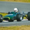
Operated Circa 1956-1959.


Member
Posted 06 July 2006 - 12:33
Advertisement

Member
Posted 06 July 2006 - 13:20
Member
Posted 06 July 2006 - 13:39

Member
Posted 16 December 2008 - 23:22

Member
Posted 17 December 2008 - 01:05

Member
Posted 17 December 2008 - 11:36


Member
Posted 17 December 2008 - 12:02

Member
Posted 19 December 2008 - 07:22
 )
)
Member
Posted 19 December 2008 - 10:54
Originally posted by Catalina Park
Speaking of nearby circuits, how about the one at Merriwa? (at least I think it was Merriwa

Member
Posted 19 December 2008 - 14:29
Member
Posted 19 December 2008 - 21:53
Originally posted by Ray Bell
I expect you'll find that's another horse race track, Henry...
They're just everywhere in this country.

Member
Posted 20 December 2008 - 00:07
Member
Posted 20 December 2008 - 00:55

Member
Posted 10 September 2014 - 23:51
Both airstrips are still there (Ringwood and Tomago) though Ringwood isn't as easy to spot due to the new freeway. It is basically still complete the last time I was there 3 years ago.
Tomago is partly obliterated by an access road, bush, a business and the Aluminium Smelter. Only a small section remains accessible off Old Punt Road by keeping left after entry to Old Punt Road. As you drive along the road, your actually on the edge of the runway. It eventually widens out before you get to business that now occupy's part of the runway. The rest has disappeared behind the smelter. However many people confuse the long, wide and cleared grass section seen from the highway which heads east between Old Punt Road and the Hunter Valley Gardens as the former Tomago airstrip.
The hillclimb you may be thinking of maybe Ringwood Park which is owned and operated by the Newcastle MG Car Club. It's located just off Italia Rd, Balikera, 10k's north of Raymond Terrace. It's on the opposite side of the freeway from the Ringwood airstrip. There are plans for expansion to a full circuit but they are having difficulty with council and and a handful of residents. The hillclimb has a number of meetings a year.

Member
Posted 11 September 2014 - 07:39
Also airstrips in that general direction were Tomago (now half-covered by a factory, I believe) and Ringwood, just near Raymond Terrace...
Ringwood you might find, and nearly opposite that, across the Pacific Highway there's some other circuit/hillclimb area that never reached completion.
Ray, the Ringwood hillclimb was certainly completed and has been in regular operation for many years now!! It is located on a site almost directly across from the old airstrip on the opposite side of the Pacific Highway. There has been a lot of recent development work undertaken there and it will host the Australian Hillclimb Championship in November this year.
Member
Posted 11 September 2014 - 07:50
Member
Posted 11 September 2014 - 21:44
As Paul has indicated the hillclimb has recently been extended and other works are being carried out in readiness for the Australian Championship in November.
The hillclimb is now separate from the proposed circuit. With different owners. Work has commenced on the construction of the circuit which will be approx 3klms in length. As far as I know at this stage all the land has been cleared, but I am unsure of any other progress.
Dale.
Member
Posted 11 September 2014 - 22:25
Member
Posted 12 September 2014 - 05:20
That's fine Ray. I am simply giving an update.
Dale.
Advertisement
Member
Posted 12 September 2014 - 06:17
Is there anyway to view the pics in this thread as they're not loading at all. I'm having problems with being able to view some pics loaded on here but not others.
Edited by gtsmunro, 12 September 2014 - 06:18.

Member
Posted 12 September 2014 - 08:34
Could you guys please repost the pictures? I can't open any of them.
Ray, I think there's nothing left at all. By 1980 it was very hard to pick up from the air, and twenty five years on it has vanished. To get there, leave Dunedoo heading east to Craboon, then bear right through Birrawa towards Mudgee. It was in a paddock, about a quarter mile from the road, about 5 km north of the Birrawa siding. If you look at the pic, you can see what was then a new road veering off to the right as you travel south, and the old road going straight on. The old raod has probably faded away by now. The property is "Wahgundy", and I suppose the current owner might know where it was exactly. You might try a 1:100,000 map of the area to compare with the pic and with the Fast Tracks map.
1/4 mile from the road to the left or the right going south?
Member
Posted 12 September 2014 - 08:36
The photos won't work because they were all hosted on Imageshack.


© MOTORSPORT NETWORK 2025. All rights reserved. Community Forum Software by IP.Board
